
The Bernina Express route is one of the most spectacular railway journeys in Europe — a 61-kilometre crossing from St. Moritz in the Swiss Alps to Tirano in the Italian Valtellina, climbing to 2,253 metres and descending to 429 metres without a single tunnel or rack section. The line is a UNESCO World Heritage Site, listed alongside the Albula Railway as part of the Rhaetian Railway in the Albula/Bernina Landscapes.
This guide covers every major stop along the route — what you will see from the window, which stations are worth leaving the train at, and how the landscape changes as the train crosses the Alps. If you are planning the journey, start here.


The route runs almost entirely above the treeline for the first half of the journey — over the Bernina Pass — before plunging south through increasingly Italian-feeling valleys. The full trip from St. Moritz to Tirano takes about 3 hours 45 minutes. Reading the route from north to south is easier to visualise: you start in a cosmopolitan mountain resort, cross a glacier-covered pass, and arrive in an Italian market town where espresso costs €1.20 and the Alps are a wall on the northern horizon.

The panoramic cars, with their raised roof and wide windows, are available on reserved Bernina Express services. Regional trains on the same track do not have panoramic cars — if the landscape is the point, reserve the Bernina Express specifically.

The Bernina Express departs from St. Moritz station, situated at the western end of Lake St. Moritz at 1,775 metres. The town is one of Switzerland's most famous ski resorts — synonymous with winter luxury, the bobsled run, and twice-hosted Winter Olympics (1928 and 1948). In summer it shifts to hiking, sailing on the lake, and the kind of slow expensive afternoon that only alpine light produces.
Most passengers board here and find their reserved seats. The train departs south, initially curving around the lake. Watch the right-hand side of the train for the first views across the Engadin valley — the broad high-altitude trough that stretches northeast toward Zernez and the Swiss National Park.

Pontresina sits just a few minutes from St. Moritz and serves as the junction where the Bernina line branches south from the main Engadin railway. It is a quieter alternative to St. Moritz as a base — a traditional village with a fraction of the prices and immediate access to the same hiking terrain.
After Pontresina, the valley narrows and the train begins its long climb toward the Bernina Pass. The vegetation thins, the peaks close in, and the Morteratsch Glacier — one of the largest glaciers in the Eastern Alps — begins to appear to the right.

Morteratsch is a request stop — passengers can get off here to walk to the Morteratsch Glacier, one of the most dramatic and accessible glaciers in Switzerland. A well-marked path from the station leads to the glacier tongue in about 45 minutes. A line of wooden posts along the path marks how far the glacier extended in each decade since 1900 — an unavoidable illustration of retreat.
The glacier is surrounded by three 4,000-metre peaks: Piz Bernina (4,049m, the highest peak in the Eastern Alps), Piz Palü (3,900m), and Bellavista (3,922m). The view from the glacier is extraordinary on clear days. If you plan to stop here, you will need to catch a later train onward — check the timetable before leaving the train.

From Bernina Diavolezza station, a cable car rises to 2,978 metres on the Diavolezza summit. The terrace restaurant at the top overlooks the Morteratsch Glacier from above — the same ice field you passed at track level — and provides a 360-degree panorama across the Bernina massif. In winter this is a ski area; in summer it is purely a viewpoint.
The train climbs steeply after this station. By the time it passes the next stop (Bernina Lagalb, the lower cable car station on the opposite slope), the landscape has become entirely arctic — bare rock, residual snow patches, and the pale light that comes with altitude above 2,000 metres.

Ospizio Bernina is the highest point on the entire route at 2,253 metres — the summit of the Bernina Pass, where the watershed divides rivers flowing north to the Rhine and south to the Po. This is the moment the train crosses from the Atlantic drainage basin to the Mediterranean.
Two lakes mark the pass: Lago Bianco (the White Lake, dammed for hydroelectric purposes, its pale colour comes from glacial sediment) and Lago Nero (the Black Lake, a natural tarn reflecting the surrounding rock). The train runs directly along the eastern shore of Lago Bianco — one of the most distinctive stretches of the journey, particularly in late autumn when the reservoir level drops and ice begins to form at the edges.

In winter, deep snowdrifts flank the track and the pass is frequently above the clouds. The Ospizio Bernina itself is a small hostel and restaurant that has been operating at the pass since the 19th century — one of the highest permanently staffed buildings in Switzerland.

Alp Grüm is a single building at 2,091 metres — a restaurant and small station perched on a ledge where the Bernina Pass road begins its descent south. The significance of this stop is the view: for the first time on the route, you look not at glaciers but downward into the Poschiavo Valley, a green agricultural valley with clear Italian character stretching ahead for 30 kilometres.
The descent from Alp Grüm is the most dramatic section of gradient on the route — the track drops nearly 700 metres in just a few kilometres through a series of tight curves and short tunnels. From the restaurant terrace (worth getting off for even 20 minutes if the timetable allows) you can watch the train snake its way down the hillside below you.


This is also the point where the vegetation suddenly changes. Behind you is the Arctic zone of the high pass; ahead, the valley fills with chestnut trees, vineyards, and by the time you reach Poschiavo, red geraniums on windowsills.


Poschiavo is the largest town in the Valposchiavo — the Italian-speaking Swiss valley that occupies the southern half of the Bernina route. It is Swiss territory, but everything about it is Italian: the language, the architecture, the food, the tempo of afternoon life.
The town's old centre, the Borgo, is a compact grid of 17th- and 18th-century houses painted in ochre, terracotta, and pale yellow — a visual shock after the grey stone villages of the German-speaking Engadin. The Piazza Comunale is flanked by the Catholic church of San Vittore and the steeple of the Spanish Palaces — a row of opulent 18th-century mansions built by families who had made fortunes as pastry chefs and confectioners in Spain, and returned to build extravagantly at home. The Poschiavini pastry tradition (the biscotti di Poschiavo and the famous torta di pane) is still very much alive.
Poschiavo is a good option if you want to break the journey and spend a night in the valley without going all the way to Tirano — quieter, entirely Swiss, and with direct train connections back north without needing to cross into Italy.
The Brusio Circular Viaduct is the most photographed structure on the entire Bernina Express route — a full circular loop built in 1908 to allow the train to lose altitude gracefully in a landscape where a conventional switchback was impossible. The train enters the viaduct, completes almost a full 360-degree turn, and exits at a lower level — briefly running parallel to itself in the loop, so passengers on one side of the train can look across and see the front of the train they are sitting in.
The viaduct is nine arches of open stone construction, now a designated feature of the UNESCO World Heritage listing. From the hillside above the village of Brusio there is a viewpoint (about 15 minutes' walk from the station) that gives the classic overhead photograph of the loop with the train in it. Timing requires checking the timetable carefully and arriving in advance — the train passes through in under two minutes.
After the viaduct, the train crosses the Swiss-Italian border at Campocologno. There is no passport control for EU and Schengen travellers; the train simply continues without stopping. The transition is marked only by a small border marker visible from the window.
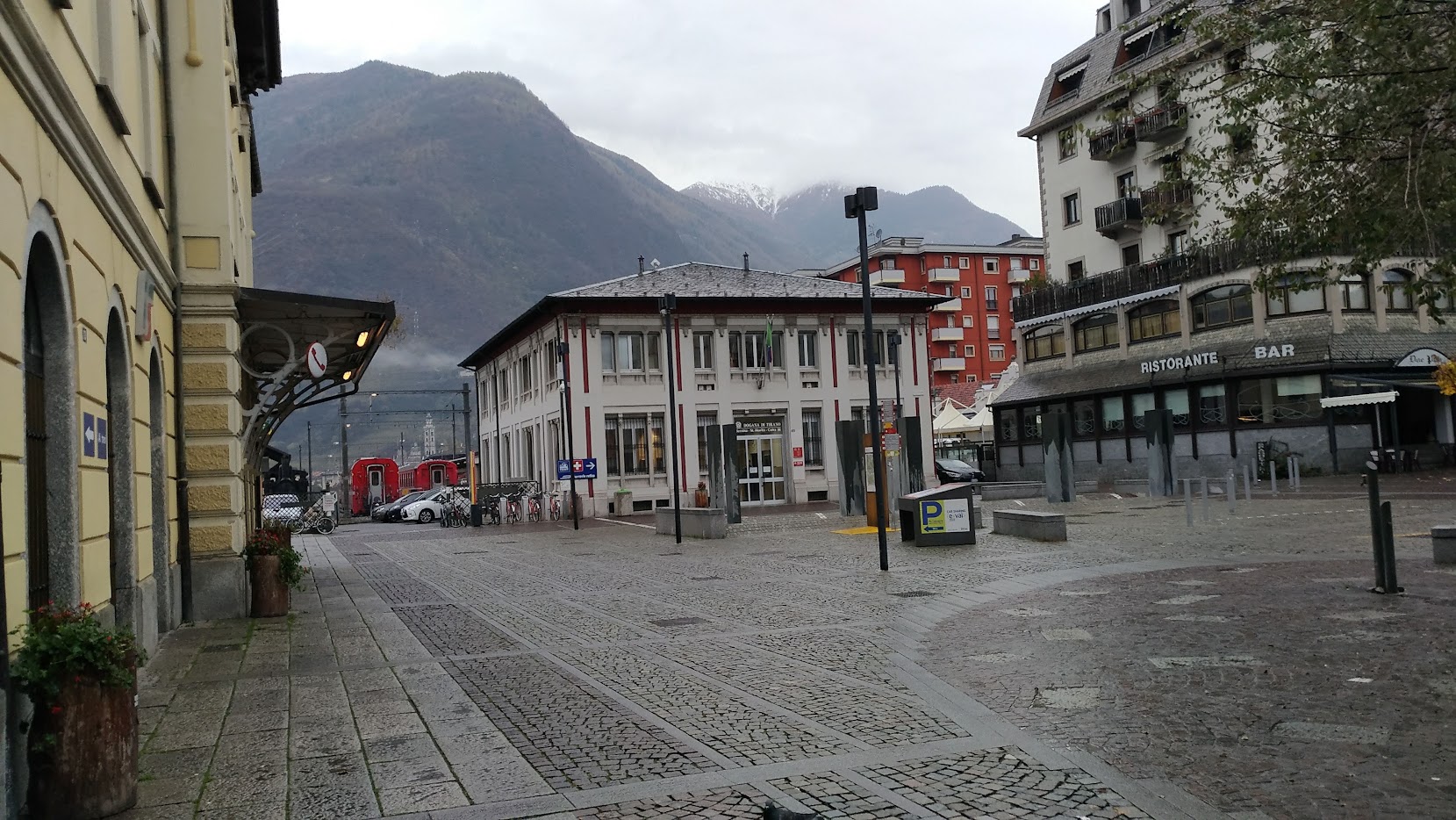
Tirano is the southern terminus of the Bernina Express route at 429 metres — almost 1,800 metres below the Ospizio Bernina crossed two hours earlier. The arrival is a sharp re-entry into a warm, market-town Mediterranean world: the train rolls through the streets at walking pace, the Basilica di Madonna di Tirano is directly opposite the station entrance, and the smell of espresso is immediate.
Most passengers turn around here, but Tirano rewards a few hours of exploration: the Basilica (a Renaissance church of real quality, built from 1505 after a reported Marian apparition), the old town with its 15th-century palaces, bresaola and Valtellina wine in the local salumerie, and the onward option of continuing to Milan by Italian train or to Lugano by PostBus over the Maloja Pass.
→ See the full guide: A Day in Tirano: Italy at the End of the Bernina Express
The Bernina Express runs in both directions. Most travellers book St. Moritz → Tirano (northbound passengers see the glacier sections first, then the dramatic descent; southbound passengers reverse this). The journey is roughly equally scenic in both directions, but the descent from Alp Grüm to Poschiavo is steeper and arguably more visually striking when seen descending (left window, southbound). The Brusio viaduct is best photographed from inside the train regardless of direction.
For a one-way trip with onward travel, St. Moritz to Tirano works well combined with a return to Switzerland via the Lugano–Maloja PostBus, making a full loop through three different Swiss and Italian landscapes in one day. The reverse — Tirano to St. Moritz — works if you are arriving from the Italian Lakes and heading north.
The UNESCO World Heritage designation covers not just the Bernina line but also the Albula Railway — the section from Chur to St. Moritz that passes through the Albula Gorge and over the Albula Pass via the Landwasser Viaduct. Adding this section extends the journey to 144 kilometres and about 7 hours total from Chur to Tirano.
The Landwasser Viaduct — six arches of curved stone construction built directly into a sheer cliff face — is the most famous engineering feature on the Albula section. It appears in virtually every photograph taken of this railway. If you have the time and the day's light, the Chur–Tirano route is one of the great full-day train journeys in Europe.
Guided Bernina Express experiences include a reserved seat in the panoramic car — the best way to ensure you get the window seat and the commentary that makes the route makes sense in real time.
View Bernina Express Experiences →